Geography in Vietnam

Happy Travellers
Flamingo planned a perfect trip for couple
Mr. Vatsal Patel
 Jan
JanFlamingo made our honeymoon truly memorable
Mr. Het Shah
 Jan
JanMaking Our holiday memorable
Mr. Mehul Diwanji
_20221114_161834.jpg&w=256&q=75) Jan
JanGreat Time With Flamingo Transworld
Dr. Yashvi Shah
 Jan
JanI Would Highly Recommend Flamingo
Mr. sagar savsani
 Jan
JanOverall Flamingo Did an Excellent Job
Mr. Chinmay shah
 Jan
JanTrip to Singapore has been extremely fabulous
Mr Meet Soni
 Jan
JanFlamingo was with us all the time virtually
Dishita Varmora
 Jan
JanMr Amit follow up were good to help us
Vishal Prajapati
 Jan
JanMr Amit made sure that we have a flawless journey
Mr Sachin patel
_20221001_170630.jpg&w=256&q=75) Jan
JanTrending travel articles
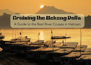
Cruising the Mekong Delta: A Guide to the Best River Cruises in Vietnam!
Of late, Vietnam is grabbing the attention of avid travelers, and the travel market is brimming with exciting options for exploring Vietnam. You will find infinite content on multiple aspects of Vietnam Tourism. Well, today the focus of my blog is all about the iconic experience of cruising the Mekong Delta. Mekong Delta is one […]
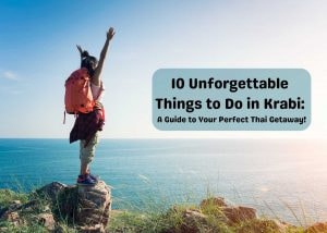
10 Unforgettable Things to Do in Krabi: A Guide to Your Perfect Thai Getaway!
Do you want to visit the white sandy beaches with amazing clear sea waves? White sand, clear sea and water adventures remind us all of only one place – Thailand! To be more specific, it’s the Krabi islands of Thailand! This stunning coastal spot is like a dream come true for all beach-lovers. You can […]
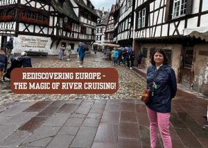
Rediscovering Europe – The Magic of River Cruising!
With over 25 years in the travel industry – I still feel that there are so many new things and experiences to explore in the world. Last month I had been to Europe – especially the Netherlands, Belgium, and London. This time I had booked a river cruise with Avalon Waterways. It was an 8-day […]

USA Budget Tour : Affordable Travel Tips and Destinations!
The United States of America is definitely a place to which most travelers across the world would one day love to head out. With breathtakingly beautiful landscapes, lively towns full of hustle and bustle, and rich cultural heritage, there’s pretty much everything not to ever be shy about. From the sun-kissed beaches of Florida to […]

Switzerland in October: Weather, Insider Tips, Best Time to Visit, and Things to Do!
Why Visit Switzerland in October? This month is one of those interesting times to visit Switzerland—the perfect blend of autumn colors with milder weather conditions and fewer crowds than in the rest of summer. As the landscape changes into shades of red, orange, and gold with the seasonal change, it offers views that are downright […]

Exploring the Wild: An Ultimate Guide to Kruger National Park!
Placed in the heart of South Africa is the Kruger National Park, its pride and the jewel in the crown of South Africa tourism. The plentiful game found alongside the magnificent landscapes creates this enormous stretch of wilderness that brings forth the finest safari experience to any visitor. From enthralling game drives to lavish lodge […]
Azerbaijan: The Ultimate Travel Destination!
Until recently, most of us were unaware of the hidden gem – Azerbaijan. However, things in the travel industry are changing rapidly. Travellers are now looking for new and different places, making Azerbaijan a discovery. It is all thanks to the Azerbaijan Tourism Board, influencers, travel bloggers, and word-of-mouth publicity. The onset of this interest […]
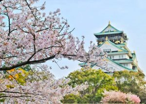
From Mt. Fuji to Tokyo Tower: 7 Reasons to Visit Japan!
Japan has a rich and varied history and is among the oldest civilizations. People from all over the world are drawn to the beautiful landscape. It includes mountains and lovely views. The Japanese take great pride in this sight. Beautiful Natural Surround Japan is the world’s most incredible travel destination. It provides many one-of-a-kind experiences. […]
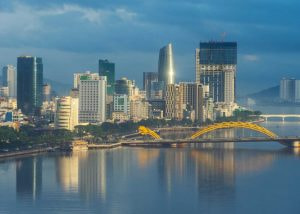
Experience Da Nang: Coastal Charms and Mountain Adventures!
“Da Nang” It’s a bustling city on Vietnam’s stunning central coast. Tourists can enjoy many activities in Da Nang. It has clean beaches, beautiful architecture, a rich culture, and delicious food. Prepare yourself to set off on an amazing adventure in this treasure of the coast. Also Read: Vietnam Tourism & Travel Guide – Places, […]

Your Ultimate Guide to the Harihar Fort Trek – Maharashtra
Harihar Fort, also called Harshagad, is a famous fort in Maharashtra, India. The massive popularity of this fort is all thanks to social media. You would have definitely seen the viral videos of a fort with vertical stairs. That is just the one I am going to share about. When I first saw the trekking […]